As the sun rose over Ohio on March 27, 2026, the state was already under the shadow of severe weather. The National Weather Service (NWS) had issued multiple tornado warnings and tornado watches in the preceding 24 hours, leaving residents and officials alike on high alert. The stark reality of the situation was underscored by the vibrant, pulsating radar screens in the fluorescent glare of the briefing room, where meteorologists and emergency responders worked in tense silence.
Tornado Warnings: Central and Northeast Ohio in the Path of Danger
The heart of Ohio was under the most immediate threat. A tornado warning remained in effect for parts of central Ohio, specifically targeting southeastern Richland County and Knox County. The NWS issued the warning as a dangerous storm system moved through the region, bringing with it the potential for devastating winds, large hail, and even tornadoes. In the hum of phones buzzing in pockets, emergency responders coordinated their efforts, ensuring that schools, hospitals, and other critical infrastructure were prepared for the potential impact. The gravity of the situation was not lost on the local communities, who had already begun to take precautions, board up windows, and seek shelter.
Tornado Watch: A Statewide Alert
While central Ohio faced the most immediate danger, the entire state was under a broader tornado watch issued by the National Weather Service. This watch, covering parts of the Midwest and Ohio Valley, was a stark reminder of the widespread nature of the impending threat. Meteorologists warned of possible tornadoes, damaging winds, and large hail, urging residents to stay vigilant and be prepared to act swiftly if conditions worsened. The watch encompassed multiple states, highlighting the regional scope of the severe weather system.
“These watches and warnings are not to be taken lightly. The potential for severe weather is high, and residents should stay informed and ready to act,” said a spokesperson for the Ohio Committee for Severe Weather Awareness, emphasizing the importance of preparedness.
As the day progressed, the situation in Northeast Ohio became increasingly tense. A tornado watch was in effect until 11 p.m. on March 26, covering major cities like Cleveland, Akron, and Canton. The watch warned of severe storms capable of producing damaging winds, large hail, and tornadoes, adding to the growing list of areas under alert.
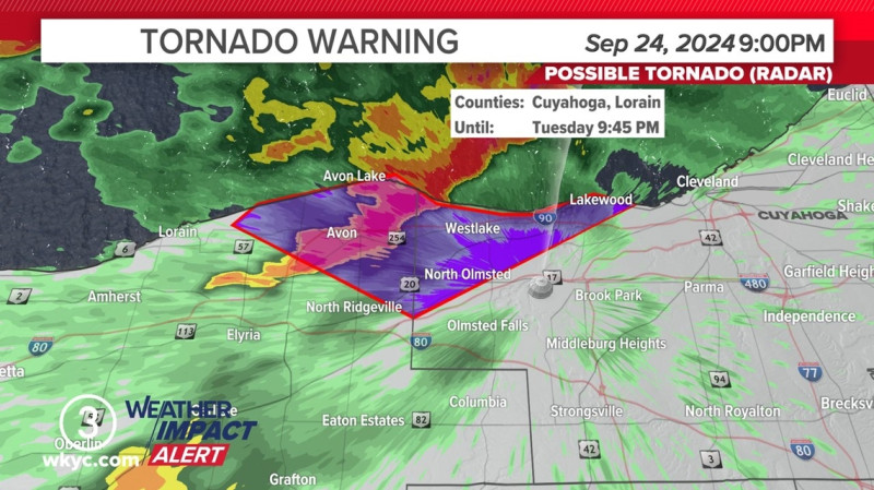
Real-Time Tracking and Community Preparedness
The real-time tracking of severe weather events has become a crucial aspect of Ohio's preparedness strategy. Through live weather maps and alert systems, residents can stay informed about the latest developments and take necessary precautions. The tornado live map, for instance, provides a dynamic display of warnings and alerts, allowing users to monitor the storm's path in real-time. The collaborative efforts of local emergency services, meteorologists, and community leaders have been instrumental in ensuring that residents are well-prepared for the impending storm. As the state braced for the potential impact, the focus remained on safety and vigilance.
With the tornado warnings and tornado watch still in effect, Ohio continues to face the threat of severe weather. The state's residents, guided by the expertise of meteorologists and the diligence of emergency responders, remain on high alert, ready to act in the face of nature's unforeseen challenges.